Tuesday, January 31, 2012

What's That Bridge Doing Way Up There????

I realize we didn't spend too much time describing Duluth in that last post but there are a bunch of things we 
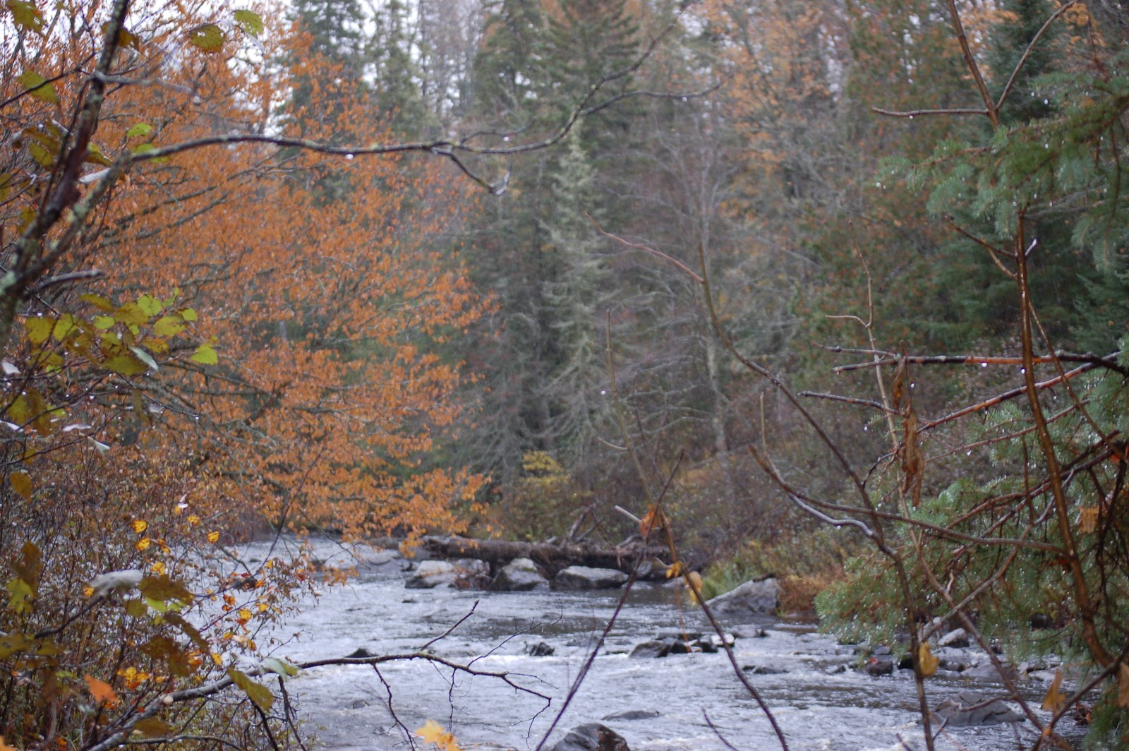
wanted to show you and we didn't want to get ahead of ourselves.  So, let's back up and see about "getting here."  As we mentioned, we came across the upper part of Wisconsin on US-2 but as we approached the city of Superior the road magically changed to US-53.  Notwithstanding the fact that our GPS, Maggie, complained (and Sherwood's GPS showed us about fifty feet into the river!!) we figured we could make it without much trouble.  Past Superior we crossed a series of bridges that span Spirit Lake, a subsidiary of Lake Superior and which seemed to me to be the mouth of the St. Louis River.  Anyway, the boundary between Wisconsin and Minnesota cuts straight down the waterway so we were suddenly in "The Land of 1,000 Lakes" and cruising down I-35!!  Lake Superior had returned to view and was demonstrating its awesome power as we came into town.

Duluth's most famous feature is clearly visible as you enter the city and you really need to see it in person to get the full impact!!  The magnificent Aerial Bridge!!!  In the mid-1800s the folks in Duluth realized that the vessels coming into the city port could substantially reduce travel time and distance if
Duluth's Famous Aerial "Lift Bridge
they didn't have to come around Minnesota Point (often called Park Point) a long finger of land sticking straight out into the lake.  So, the decision was made to cut a canal through the sandy land spit and it was completed in 1871.  Problem was, the folks who lived or worked on the point had a very hard time getting to the mainland.  So, a contest was held to see who could come up with the best idea for dealing with the problem.  A fellow named John Waddel proposed a "lift bridge" and was proclaimed winner of the contest.  Unfortunately, the U. S. War Department objected and the project was cancelled.  Waddell's bridge was later built in Chicago.   A subsequent design was adopted incorporating an aerial "gondola" that could transport heavy loads and hundreds of people.  Although it worked and was put in place in the early 1900s, it was inadequate for the growing transportation needs.  So, in the late 1920s modifications were approved that incorporated the "lift-bridge" design almost exactly as Waddell proposed nearly forty years earlier.  And the company that completed the renovation is a descendant of the company he originally founded!!  The bridge spans nearly 400 feet and rises to around 180 feet when elevated. There have been only two bridges of this design ever made - the one in Chicago (since removed) and this one.  The picture above and to the right shows the bridge (just to the left of the clock tower) as it relates to the point.

The downtown area is chock full of great stuff to see with numerous art galleries, stores offering crafts and gifts of all kinds and - especially pleasing to me - lots of music stores.  Amazingly, we found the shop of a violin luthier, Christian Eggert and had a great time talking to his young assistant.  We were also impressed with the statuary that abounded in the craft village along the harbor.  It reminded us of a city we visited in Colorado a while back.  A story for another day.  
St. Scholastica College

Duluth is home to several colleges including the Univ. of Minnesota at Duluth, Lake Superior College and the College of St. Scholastica.  We took time to visit the latter mainly
Sculpture-St. Scholastica
because the history of the college's namesake was so interesting.  St. Scholastica was the twin sister of St. Benedict and she, like her famous  
brother, dedicated her life to God at an early age.  She eventually founded and led a community of nuns at Plombriola - about five miles from St. Benedict's
Stairway - St. Scholastica
monastery in Monte Cassino.  She died  in 547 AD at age 67.  Many amazing events have been related to the saintly lady.  She is considered patron saint of nuns and children with seizure disorders.  Because some of the kids we had worked with could really use her help we decided a visit to pay our respects couldn't hurt.

There is one other place we would like to take you before we close out this part of our day.  We had read about a place called "Hawk Ridge" and, since Linda considers hawks to be her private "totem" we thought it would be an interesting place to see.  Duluth lies right along the shore of Lake Superior but a steep ridge rises sharply to a peak with a spectacular view of the city and the lake.  The ridge is reached by way of the somewhat oddly named "Skyline Parkway."  Despite its name, the road is rather small and can be difficult to find if you are not paying close attention.  I'm not going to try to give directions here but be sure to get some before you head out.  The Hawk Ridge Nature Reserve is a privately funded and staffed operation but the number of people involved as volunteers was absolutely amazing.  We added several pictures here to try to give you a look at both the beauty and the busy nature of the place.  We were there right at the tail end of the peak viewing season but we still got to see quite a few birds.  The above picture of a Red-tailed Hawk was taken by Linda right after we got there.  As I understand it, birds of prey or "raptors" migrate to the southeast from as far away as the arctic and shy away from the vast lake.  That causes them to drop down to the area around Duluth before turning East again.  The number of raptors that pass this place is  astonishing, averaging more than 82,000 birds each fall!!!  And - the different types is equally impressive with hawks including - Broad-winged, Red-tailed, Red-shouldered, Swainson’s, Ferruginous, Rough-legged, Sharp-shinned, Coopers and Northern Goshawk.  At least five kinds of owls, several kinds of eagle including our famous Bald Eagle and the lesser known Golden Eagle - many vultures and numerous other birds of prey round out the visitors list.  As you can see from the pictures, the ridge is a popular place for amateur ornithologists of all ages and the volunteers from the Nature Reserve are all to happy to assist in identifications and in alerting viewers to incoming birds.  I've gotta tell ya, it might sound a little strange until you actually experience it but you can really get caught up in the excitement of a new "spotting."  If you get to Duluth - particularly between August and October - please try to get up to the ridge at least for a little while.

We visited a lot of other places we want to share with you but we don't want to wear you out too badly.  We'll stop now but we'll be back to continue our visit to Duluth shortly.  Before we go, though, let me mention something some of our younger folks might not have realized.  First - the huge ships that carry ore across Lake Superior are called "lakers."  Well, when the city of Minneapolis decided to have a professional basketball team they wanted a name that symbolized their part of the country.  What better name than that of the ships that were so powerful and so vital to this area ..."The Lakers!!"  Yep, the team is in L.A. now but they still bear that proud name.  Come back soon for a lot more!!  See ya.

Monday, January 30, 2012

Duluth - Here We Come!!!!!

OK - so we had an unusual adventure on that exotic finger of land which sticks so far out into Lake Superior it almost reaches the Canadian border running down the middle of the lake.  Now, we're back on the mainland headed West back into Wisconsin.  Maggie (our faithful GPS) had been having a real hard time and we thought she was about to have a stroke.  Back on the Keweenaw we left US-41 and came down US-45.  As we reached Wakefield and turned more directly westward we found that, somehow, we were back on US-41 again.  That didn't last long, though, because when we pulled out of Wakefield, we found we had joined up with US-2 which would take us all the way to Duluth.  Not far down the road, at Ironwood, we left Michigan and re-entered Wisconsin.  The highway across this part of "The Badger State" was well inland and except for when we elbowed our way back to the coast somewhere near Ashland we didn't see much of Lake Superior until we got to Minnesota.  All this gave us lots of time to ponder the numbers of the fascinating byways we were traveling.  I'm not going to try to  do some kind of seminar but, the numbering system began in about 1924 and U.S. highways go from 1 to 830!!!  Seems like the country was pushing for companies to publish maps and they mapmakers responded ... "How the hell are we supposed to tell you where to turn?"  Clearly, in a huge country directions such as "... turn left at the first tree past the Jones farm..."  are not going to work  As most of you might know, our North-South highways have "odd" numbers and the East-West ones are "even."  You get into some variations around towns where Interstate highways form loops but, by and large, our Interstate Highway System is an engineering marvel.  But, there is a price to pay - blandness!!!  They have standardized much of the scenery across the land and, for that, I regret them.  But - that's OK - that means there are less folks out there on the "...roads less traveled.." and that's nice.  If you ever get a chance there are three books related to spontaneous travel in our country and I highly recommend them.  They are getting quite old now but do consider them.  First - the seminal U. S. travel book is "On The Road" by Jack Kerouac written in about 1951.  It was then that coming out of WW-II the U.S. found its young people searching for new identities.  Kerouac became the spokesman for that generation, creating the term "..the beat generation.." to describe them.  (Beatniks!!)  The second one is by one of my favorite people of all time - Charles Kuralt (a North Carolinian).  He titled his book "On The Road" also but he gave us a bonus.  He chronicled his travels with a series of videos that were incredibly poignant.  The third one is by an author that I feel has to have one of the neatest names of all time ... William Least Heat Moon ... who wrote the marvelous "Blue Highways."  I feel an obligation to add two others authors you should take a look at - John Steinbeck, particularly in his last book "Travels With Charlie" and James Michener who has chronicled the development of our country - and others - like few other authors.  Steinbeck and Michener
Tamarack
are probably my two favorite authors of all time and their matchless prose will make your heart cry - and sing!!!  But OUR objective right now is to get this buggy down the road to Duluth, Minnesota where we will stop for a while.  There is much to tell about before we hit the sack tonight but all this rambling about roads has probably worn you out.  So, I'll let some of the sights we saw on the way to - and as we entered - Duluth do their own talking.   But, first - take a look at this really neat tree.  I know you folks from about Virginia on up to Canada are very familiar with the species but us "sandlappers" rarely see them.  It is a "Tamarack" and it is not only beautiful but the range of medicinal and nutritional uses it has are extensive.  (Yes, its foliage is, indeed, changing for the winter.)  Although it is also known as a "Larch" in many places I like its "real" name because it is the Abenaki Indian word for "... wood used for snowshoes!!!"  We think you'll find Duluth a cool place to visit and the folks we'll tell you about were fascinating - so - rest up and come on back.  See ya.


Sunday, January 29, 2012

The Keweenaw Peninsula and Copper Harbor.

After a great evening snuggled down in the romantic and remote Eagle River Inn we awoke to skies that had decided to give us a break.  The sun had joined us and was urging us to get on the road to see the stuff around the next bend.  We spent some time trying to figure out how we were supposed to check out of an Inn that was decidedly "low-key" and finally realized that we'd probably have to do it by e-mail.  (Hmmmmm.....)  We had checked the internet the night before - thanks to a spectacularly effective USB internet card we got from Alltel Communications and had learned that we could get breakfast in Copper Harbor way out at the end of the Keweenaw Peninsula.  (In case you don't get the significance of our ability to check the internet, most cell phone service does not come close to working in this remote place!!!)  So, we got packed up, left our wonderful inn, said goodbye to Eagle River, county seat of Keweenaw County, and pointed ourselves North once again.  The road to Copper Harbor was really beautiful in the early morning sunlight with the fall foliage splashing vivid colors all around us.  We reached the town of Copper Harbor and did, indeed, find "The Pines" restaurant open for business and anxious to get us started off on another great travel day.  Our breakfast was excellent - complete with a full cast of "real characters" from the local area!!!  Later, we took the time to find the dock where the ferry to Isle Royal State Park departs when running but realized that at this time of the year it was doubtful we could get there safely.  The park is a huge island - forty-five miles long and nine miles wide - way out in Lake Superior and is the beautiful home to a large pack of Timber Wolves - which Linda was hoping to see.  In addition there is a considerable herd of moose and a number of other animal species whose numbers are difficult to determine since they can so easily travel back and forth to the Canadian mainland during the winter when the lake surface is frozen.  The land behind Copper Harbor rises to a peak hundreds of feet high and there are a number of spots that offer breathtaking views of the lake and the surrounding countryside.  In fact we were absolutely stunned when we found that at one spot we were 726 feet above the surface of the lake but we were also 1328 feet above SEA LEVEL!!!   We'll add a few pictures we took there and hope they convey even a fraction of the beauty of this enjoyable place.  It seemed such a peaceful and idyllic site to us but we were fully aware of the ore mining and shipping operations that have been such a vital part of the local economy since the 1840s.  Now .... think about this extraordinarily remote place - even in today's times.  What it would have been like in 1843 when the Lake Superior Copper Company started their mining
Eagle River Falls
operation here?  Got it???  Well, then, I guess you can fully understand that only seven years later, the Knivel Brewery opened a thriving business serving the German, Cornish, Irish and Prussian immigrants settling here.  (I get it!!)  The scenery and the history are definitely alluring here but we've got lots of things to see and do so we got back on the road South - heading down the peninsula.  Now  remember, we got up here in the middle of a driving rainstorm.  Going back in sunny skies, with a lot less pressure to make good time, we had a chance to notice where we were.  We were startled to see our old friend, "US-41" had joined us again and we took a look at where it would take us.  Imagine our surprise when we found that we were actually at the "starting point" of this fabled roadway!!!  On a whim we got Maggie to check the map and found that it extends almost exactly 2,000 miles from Copper Harbor to Miami, crossing the states of Michigan, Wisconsin, Illinois, Indiana, Kentucky, Tennessee, Georgia and, ultimately, Florida!!  Wow!!! And - it was made further poignant by the fact that at the terminal point of the highway in Miami, it "dead-ends" into US-1.  As you may know, that august roadway runs from Maine to Key West, Florida (right off Duvall Street) and also runs within a stone's throw of our beautiful Ridgeway!!!!!  It is a small world isn't it??  But - while I was doing the 'geographic musing' my co-pilots were reminding me that we had a long way to go before our next overnight stop.  And - shortly we saw that we would leave US-41 and fork right onto US-45.  So we dropped off of the Keweenaw in high gear and headed West.  As we reached the mainland we noticed that we would soon be re-entering Wisconsin (?) and that we were  close to a "Welcome Center."  Being the age we are, we rarely pass up a Welcome Center but this one had an added attraction - an enormous statue of a native American (and a bear) in the yard.  We stopped at the center and were introduced to two of the most engaging and impressive characters we met on our trip.  The guys who were manning the welcome center were long-time Yuppers and loved their frosty northern habitat.  They were only too happy to tell us the history of the statue we were curious about.  Turns out this old fellow, who goes by the name of Nee-Gaw-Nee-Gaw-Bow,  resides in the small town of Wakefield, Michigan and was carved by a  fellow who was born in Hungary by the name of Peter Toth.  As a young artist, Mr. Toth decided that it was his mission in life to make sure that the Native American and Aboriginal Canadian people were never taken for granted.  (Think back on Father Baraga's epiphany.)  He came to the United States and set out to carve statues of notable Native Americans in every one of the fifty states in what he would eventually describe as "The Trail of Whispering Giants."  He completed his U. S. quest (South Carolina was #23), added many statues throughout Canada and has sculpted memorials in many European locations.  This young man (hey, he's four years younger than I am!!) has made a contribution to our countries - U. S. and Canada - and our histories (all of us, worldwide!!) that cannot be calculated.  He has reminded us of our common brotherhood and how we are so very inter-connected.  That's a great note to end this post on  - but - we're still on the road so get back here quickly so we can bring you up-to-date.  See ya.

Saturday, January 28, 2012

Editorial Note **

Folks, we've admitted to being rank amateurs when it comes to this blogging stuff and just wanted to let you know what happened with the post about "Eagle River and ... The Grand Canyon???".  We've been trying to prepare posts a little ahead of time in order to make sure they are OK before they go out.  (Yeah, we usually 'write-as-we-go.')  Well, we actually got one ready early enough so it could wait until the following morning (this morning) to be sent.  It was saved and a timer set for it to be posted at 6:00 am (First time we'd tried that.)  When we looked to see if it went out, lo and behold, it had disappeared!!!!  We reconstructed a portion of it but had to wait until the afternoon to fully restore it.  It's out there now if you would like to go back and see the stuff we left out.

We mention all this not so much to apologize (which we do) as to warn you --- keep a back-up of your stuff!!!!!  It will likely come in handy one day.  Anyway - thanks for being so patient with us.  We appreciate it!!  See ya.

Eagle River and ... The Grand Canyon???

In Marquette we got our first glimpse of the magnificent Lake Superior.  I'm not a Linguist but the origin of 'place names' we use to describe things has always interested me.  For example, one of our local road signs got a lot of publicity a while back.  It was a sign that pointed the way to two of our towns but a lot of folks used it to "make a statement."  No, I'm not getting all political on you, in fact, I just wanted to tell you about "Prosperity."  You see, the little town was originally named "Frog Level" when it was chartered in 1851 and remained that until 1873 when the townsfolk decided they deserved a more distinguished name and officially changed it to Prosperity.  Well, the origin of the name "Lake Superior" was not quite that bad but, it is interesting.  Seems that the French trappers who originally lived and hunted in this area referred to the lake as "le lac superieur" meaning "the upper lake."  During the French and Indian Wars, the British, ever the creative land managers, dubbed the lake "Lake Superior" explaining that it was, indeed, the largest on the continent. People have always used unusual designations for the rivers, lakes, mountains, territories and often even their homes as a way of commemorating events, people or things.of importance to them.  As we traveled northwestward we began to see two recurring words - "Baraga" and "Grand Canyon."  The former we weren't familiar with but the latter, having last seen it in Arizona and doubting that it had been moved, piqued our interest.  We pulled into a park where it was mentioned and decided to take a look.  The signs we saw indicated that the trail was about two miles long.  By that time it had begun to rain rather hard so we decided to go only a little way to a river running nearby.  The Sturgeon River is a swiftly flowing waterway busily carving its way through the rocky landscape and the unusual color of the water
Grand Canyon of Michigan

testifies to the presence of tannin from the fallen leaves and brush.  Down below where we stood the river drops over the fifteen foot high "Canyon Falls" and enters the 300 foot deep "Grand Canyon of Michigan."  The canyon, while about 5,700 feet shy of the one in Arizona, is impressive in its own right and the people of Michigan have every right to be proud of this beautiful feature.  While we did not make it all the way to the canyon because of the weather and the distance I did find a picture of it so you could see its beauty.  We really regret not being able to make it the whole way down the trail and if you're ever in this area we certainly encourage you to do so.  It was also at about this time that we realized that Canyon Falls and the Grand Canyon of Michigan are both located within the boundaries of Baraga State Park which, in turn, is in Baraga County along the Keweenaw Bay so we were still wondering......  Not much farther along US-41 we saw signs indicating the way to the "Bishop Baraga Shrine" and it was there that we learned ... "the rest of the story!"  Frederic Baraga was born in Slovenia in 1797 and, following the death of his parents, was raised in the home of a professor at the clerical seminary at Laibach.  Although in 1821 he graduated from the University of Vienna with a degree in law his thoughts were frequently occupied with clerical matters and in that same year he entered the seminary.  He was ordained as a priest in 1823 and for the next seven years rapidly established an excellent reputation.  In 1830 he came to believe that his true calling was to minister to the Native Americans and Aboriginal Canadians so he left Europe for North America and embarked on a ministry that is one of the most successful, often astonishing and always inspiring stories imaginable.  His work among the people of Canada and the United States continued for the next thirty eight years including consecration as the first Bishop of the upper peninsula of Michigan in 1853.  The shrine that memorializes this extraordinary individual is, itself, remarkable.  It includes plaques highlighting his achievements and you'll really want to take the time to read them.  The memorial itself consists of a huge, thirty foot, copper statue of Fr. Baraga standing on a cloud of stainless steel.  The cloud is supported by five laminated wooden supports symbolizing his five missions.  It sits on a bluff overlooking Keweenaw Bay allowing this saintly man to continue watching over his flock.  It was great to visit the shrine but we had a long way to go in order to get to our home for the night, the Eagle River Inn.  Rain had begun falling again and with twilight coming on fast we needed to get going.  By the time we made our way up the remote highway to the inn the rain was coming down in buckets.  Our arrival was a bit soggy and made somewhat mysterious by our reception there. I won't go into detail but, let it suffice to say - there wasn't anyone around!  We did manage to get checked into our rooms and looked out the windows to see - WATER!  Yep, the inn couldn't be closer to the lake without being a hotel for fish!!  We took photos showing the shoreline from our back door so you could see for yourselves! And, while the local folks might be used to all of this, for us it was rather enchanting to share a bottle of wine sitting next to a large window overlooking this turbulent fresh water ocean with the wind swept rain rushing noisily around the eaves.  So, we'll close on that note and start getting prepared for tomorrow's adventures.  See ya.

Friday, January 27, 2012

Our First Glimpse .....

As morning opened its windows on the steel gray skies of northern Wisconsin, we headed out of Green Bay, continuing northward on Highway U.S. 41 .... at least I thought we did!!! Turns out that US-41 somehow "clones" itself and has twin routes that parallel each other. Well, you know me, I'm trying to stay alongside Lake Michigan and it looks like I can do that on "41". No ... the road that goes that way now has the mysterious name "M-35". (Sounds like one of James Bond's bosses.)  Now, you've gotta picture this - I've got two aggressive "co-pilots" and a GPS (which we named Maggie) whose favorite and most frequently repeated phrase is... "When possible make a legal 'U' turn!". Yeah, you get the picture...... But, after a brief conference we 'muted' Maggie and continued on our merry way - up M-35.  As you saw from the earlier post, the weather in this area was often overcast and misty.  It brings vividly to light the effect the moisture from the enormous bodies of water that make up the Great Lakes have on the weather for hundreds of miles.  But please don't get the impression that we didn't get our share of sunshine - we did.  And, for folks from an area where the city slogan of our state capital, Columbia, is ... "Famously Hot" ... we can stand a little overcast now and then.  And, the skies certainly don't diminish the beauty of the area.  We were fortunate that the foliage was still bright at the time of our travels and we were treated to some rather great views but - as you will see in a while - we had a lot of really spectacular scenery yet to come. One of the things we have done as we travel is to keep a "running map" of the route we take.  That way we can not only track our progress but we can better explain to folks exactly where we are - or have been.  I'll put the map that showed the first few days of our travels on this post so you can see what I mean.  I'll update it periodically - but not too often.  Sometimes a map can get boring!! Anyway, we proceeded up Lake Michigan, crossed over from Wisconsin into the state of Michigan and turned northwestward toward Lake Superior.  (By the way - as we began to turn westward we found that, lo and behold, we were back on US-41.  Go figure!!)  At Marquette, Michigan we got our first glimpse of that stunningly large body of water and were, frankly, awestruck.  But first - Marquette!!    Well, what can I say???  For someone who was not familiar with this small city I was frankly unprepared for the absolute treasures the town has to offer.  As the home of Northwestern Michigan University, it certainly has the opportunity for higher education right at the doorstep but the other features of the place are amazing!!!  Marquette was ranked Number 3 on Forbes Magazines list of best small cities in the U. S. in which to raise a family.  And - it was rated 7 out of 200 on the list of greatest cities for outdoorsmen.  Now, let me do a little qualifying here, folks.  Marquette is definitely a quality destination - but - if you're coming here in winter, be prepared.  They have one of the highest snowfall rates in the U. S. with over 140 inches per year.  Whoa!!! That's more than ten feet!!!!!  But, they capitalize on that weather in a huge way.  The winter sports opportunities here are boundless  - and - have resulted in Marquette becoming the site of the U. S. Olympic Education Center and the Snowboarding and Skiing Hall of Fame!!!  We found the architecture in the city to be rather remarkable in that there is certainly an abundance of modern and attractive buildings but many of those downtown buildings give the impression that they are from an earlier era.  But they are still fresh and attractive.  The city Harbor hosts a marina and a boatyard where maintenance work is done on the huge lake-going ships that spend so much time in this major ore-shipping port.  The park alongside the harbor is really attractive and in the spring and summer would be a great place for the kids from the University to take a break from their strenuous academic routine.  Even though the population is slightly under 25,000, Marquette is one of the larger cities on the "Upper Peninsula" That term has resulted in a word none of us had heard before - "Yupper".  We saw it in writing several places before we had a chance to inquire about it.  The name, pronounced You-per, designates a resident of Michigan's upper peninsula.  We understand that to be a "real" Yupper one has to have survived at least a "six-foot snowfall" winter. My hat's off to them!!  We plan to make it all the way up to Eagle River on the Keeweenaw Peninsula on this leg of our journey but, there is so much to talk about between here and there, we'll close this post to give you a break and continue a little later.  We've got some really interesting and fun stuff to show you so join us as we explore further into the land around what the Ojibwe Indians called "Gichigami" (big water) - and which was called "Gitche Gumee" by both the poet Henry Wadsworth Longfellow in his "Song of Hiawatha" and by songwriter Gordon Lightfoot in his classic "The Wreck of the Edmund Fitzgerald."  Whichever name you use, Lake Superior, the largest freshwater lake in the world in surface area, is an awesome sight.  And - since we were seeing it at about the same time of year the Edmund Fitzgerald went down, we could imagine the weather those unfortunate souls faced.   So - come on back and we'll check it out together.  See ya.