Good Morning gang,
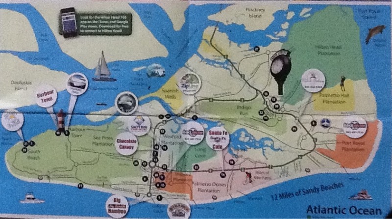
We're still getting geared up for the day but we thought it might be helpful if you had a better idea of where we actually are. Soooo - I'm adding a crude map of the island from one of the ten thousand brochures we seem to collect as soon as we step out the door. Normally, Sherwood is the "keeper of the maps" and always has the best info about our location - but, we're traveling short-handed this time so bear with me. Here's Hilton Head.

Linda says the island looks like a shoe so that is a great way to give you a frame of reference. To start, look at the top left of the shoe and you'll see a portion of Pinkney Island. The highway that cuts across the tip is the only roadway onto the island. If you draw a line from that point down to the 'toe', that would be close to the "north-south" directional line. Down by the 'arch' you'll see Palmetto Dunes. That's where we are. Down near the top of the 'big toe' you'll see the lighthouse that is one of the most recognizable images of HH. In actuality, the main downtown area is located near the orange section to the left of Palmetto Dunes. We talked about Pinkney Island yesterday and Bluffton is just above that.
I think that's enough of a geography lesson for now. The island is quite large but we'll try to help you understand it better as we go along. We're going to try to visit several interesting spots today so hang around and join us. See ya!
- Posted using BlogPress from my iPad
No comments:
Post a Comment
We would enjoy hearing from you if you would like to send us a note!!